


Insano
[PC] GSAK (Geocaching Swiss Army Knife)
![[PC] GSAK (Geocaching Swiss Army Knife)](/media/k2/items/cache/42121f00ffc451d0c288e11c1f28cbd4_Generic.jpg)
GSAK (Geocaching Swiss Army Knife)
Licença: Shareware
Link: gsak.net
- Code:
Features:
# Multiple waypoint databases
# Databases format in industry stand SQLite format.
# Import individual GPX/LOC files or a whole folder
# Display waypoint offline in browser or split screen view (live Internet connection not required)
# Display waypoint online (uses a link to http://www.geocaching.com by default, but the URL is user configurable)
# Custom URL's for each waypoint, and waypoints as a group.
# Automation of tasks (macros or batch processing)
# Set centre points by post code, GPSr, location, or waypoint.
# Comprehensive filters to search/select a subset of your data (subsets can be saved and restored)
# Export to the following formats: MapSend WPT, OziExplorer WPT, http://www.geocaching.com GPX and LOC format, MapSource, Fugawi, Street Atlas, Pocket Streets, Microsoft Streets and Trips, Magellan Protocol (SD card), Magellan eXplorist, Lowrance USR, TomTom POI files, Maptech eXchange format, CacheMate, and National Geographic TOPO!.
# GPSBabel Custom Export. This enables generation of other lesser known formats such as Tiger, GPSUtil, Delorme XMap, Delorme XMapWpt, PsiTrex, PCX, CETUS, Quovadis, GPSPilot, MagNav, Microsoft PocketStreets PSP, NaviTrak DNA, Holux, TopoMapPro Place files, GpsDrive, Geocaching DB, CoPilot, EasyGPS, GPilotS, GeocachingDB, NIMA, MapConverter, NaviCache and PsiTrex.
# Generation HTML for download to your PDA
# Direct upload of waypoints to GPS receiver
# Add "corrected coordinates" to a waypoint description
# customize waypoint description for offline HTML pages
# customize HTML formats
# User Notes.  You can also import and export notes in text format
# Ascending/descending and mulit column sorting of columns in the offline database
# Instant counts (colour coded) for found, not found, placed, and archived waypoints in the displayed database
# Ability to set centre point for calculation of distance and bearing
# Change column size of all browse view headings
# Change column order of all browse view headings (just drag heading)
# Select individual columns to display in the grid
# Repair and delete the database
# Backup and restore of databases and settings
# Drag and drop support (including zipped files from http://www.geocaching.com)
# File association support
# UTM coordinates show in HTML view
# Convert State names to abbreviations (Australian, US, Canada, State names and abbreviations  provided by default)
# LOC file support (from http://www.geocaching.com and from other sources)
# Unlimited log history
# Instant iconic views for Travel Bugs, waypoint type, user notes, and last four logs
# Split screen view with four formats:  full waypoint display, description only, logs only, or log summary
# Quick Search: instant waypoint search on partial waypoint name
# User flag for individual waypoint selection
# Delete a waypoint: with an option to prevent next GPX load from re-adding it (add to ignore list)
# Delete multiple waypoints, based on a filter
# Identify your "Placed by" (hidden) waypoints using exact match, wild cards, or http://www.geocaching.com Owner ID
# Identify and flag archived waypoints
# Special WebCam cache support
# Add and edit your own waypoints
# Special "smart name" calculation for meaningful unique waypoints.
# Macro language
# Semi automatic cache logging
# Terracaching.com GPX file support
# Customizable tool bar
# Coordinate Grabber from free floating text
# Before and after image change log
Screenshots: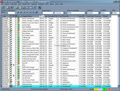
[WEB] GPS Mod Driver
![[WEB] GPS Mod Driver](/media/k2/items/cache/51a3864ed3ad604d2340c3f8fe249f94_Generic.jpg)
No fórum da xda-developers, podem encontrar um artigo bastante interessante, sobre: GPS Mod Driver - Lag Fix, GeoCaching Fix, Hardware Compass Support, Multi-Device
Podem ver aqui
Uma das vantagens é ter o modo de condução e modo de caminhada, podemos comutar para um ou para outro e alterar os parâmetros.
Foi criado especialmente para os PPC que utilizam os processadores Qualcomm, o caso dos novos HTC.
Já testei e gostei dos resultados.
Nos parâmetros do modo de condução deixei tudo na mesma, no modo de caminhada, alterei o seguinte:
Distance moved: 1
Zero Speed Time: 1000
Minimum Speed: 0
'Toggle Enamble', marquei o 'Prefer GPS' (nas duas opções)
[Symbian] BlueSky GPS
![[Symbian] BlueSky GPS](/media/k2/items/cache/737344dd8934cc52da9f7f85f2627abb_Generic.jpg)
O BlueSky GPS é um programa Shareware para symbian e permite aventuramos-nos na procura das caches.


Brief summary of features:
* show GPS satellites and coordinates
* add, edit, import and export waypoints
* sending your position by SMS
* history of sent and received SMS
* navigation to selected point or to the nearest point
* speedometer with two ranges
* blank map with points and track
* trip computer
* logging NMEA sentences
* settings
Mais informação na pagina oficial